
Looking Up Your Newington Neighbors
A block lookup is a small geography problem. Begin with one seed address, identify its parcel and unique ID, then decide whether the goal is a map, owner lead, district, historical household, or community resource. The table keeps the source roles separate.
| Source | What it shows about a block | Access |
|---|---|---|
| MapXpress parcel layer | Adjacent parcel shapes, owner/property popup, unique IDs, abutters | Public map, click and browse |
| GIS layers | Voting, zoning, wetland, flood, school, fire, historic, aerial context | Public layer controls |
| Assessor street search | Owner display, location, values, building and permit clues | Public property portal |
| Street Listings by District | Street ranges and polling district | Official dated PDF |
| Historical directory | Dated names and addresses along a street | Library, archive, or microfilm |
| Community repository | House, school, cemetery, map, and civic-history leads | Library or Historical Society request |
An owner display is not an occupant list. An adjacent parcel is not proof that a household is related to the seed address. A historical listing needs a year and page.
Mapping Newington Neighbors by Parcel
Newington GIS describes parcel ownership, detailed property attributes, abutters, and printable maps. MapXpress accepts Property Search Name, House No, Street, Parcel Id, and Unique ID. The parcel-ID example is 10/704/000, while the assessor uses its own MBL and unique-ID fields. Preserve both when a search crosses systems.
- Locate the seed address or unique ID in the Newington MapXpress viewer and save the parcel popup.
- Record the selected parcel, map date, scale, street, parcel ID, and assessor unique ID.
- Click the surrounding parcels or use multi-select and buffer tools. Record each parcel separately rather than making one block-wide name claim.
- Turn on only the layers needed for the question, such as voting, zoning, wetlands, historic aerials, or flood context.
- Use the assessor card or Town Clerk record only when an owner, deed, permit, or date needs an underlying custodian.
The GIS office states that parcel maps were updated July 2026 and property information is updated nightly. Map date and property date should travel with the output.
The public parcel viewer shows the adjacent-parcel controls.
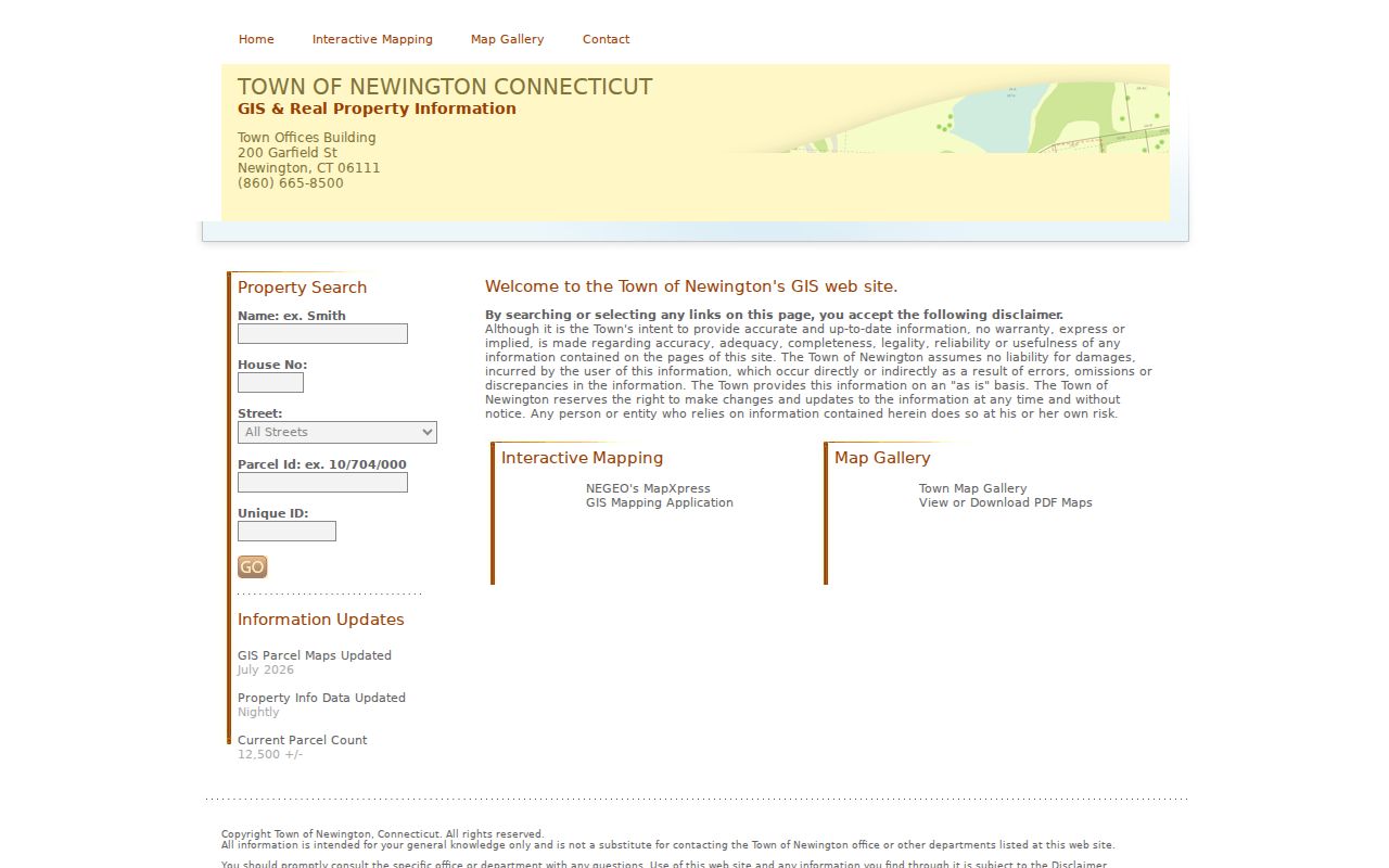
The capture supports a parcel workflow, not a household roster. A buffer is a selection convenience, not a legal definition of a neighborhood.
Newington Neighbor Records in GIS
The Newington GIS Services page describes parcel mapping, ownership queries, aerials, wetlands, flood data, and map printing. The Interactive Mapping hub also links the parcel, public-safety, revaluation, polling, stormwater, and park applications. Those apps can add shared context for Newington neighbors without exposing a private household record.
MapXpress offers sales layers by Grand List year from 2021 through 2025, historic aerials from 2004, 2012, 2016, 2019, and 2023, zoning and overlay controls, easements, storm sewer, inland wetlands, FEMA flood zones, and other state or federal layers. A map layer can show that two parcels share a district or physical feature. It does not decide title, occupancy, or a person's relationship to the property.
The Newington GIS Services page and its parcel-information capture show the public orientation.
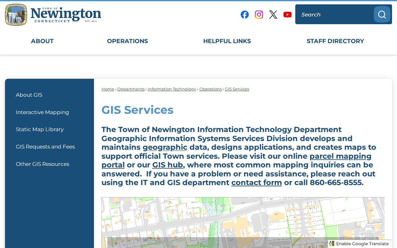
For a repeatable map, preserve the layer names, selected parcel, scale, print setting, and date. If the question becomes a whole named street, switch to the Newington street directory rather than expanding a block buffer indefinitely.
Newington Neighbor Geography on Berlin Turnpike
Berlin Turnpike is a useful Newington test because the official district list splits its number ranges. Numbers 2089-2335 are listed in district 001, 2355-2909 in district 002, and 2920-3585 in district 005. Nearby addresses on the same named road can therefore have different polling places and state legislative context.
This is not a ZIP code rule. It is a dated street-range rule. Use the exact number, the Street Listings by District PDF, and the current polling-place page. The listed buildings are Mortensen Community Center and Town Hall, Ruth Chaffee School, Anna Reynolds School, Elizabeth Green School, John Paterson School, John Wallace Middle School, and Martin Kellogg Middle School for districts 1 through 7.
Note: The district listing was printed June 27, 2022. Check the current election-cycle page before treating a range or building as current.
Newington Neighbor Owner Leads
The assessor can show a taxable owner, a situs or mailing field if displayed, property use, values, sales clues, building characteristics, and permits. The Town Clerk deed can show recorded parties. The tax portal can show a taxpayer or account lead. None of these sources enumerates every person who uses the parcel.
A public property card is useful for deciding which record office to ask next. It is not a residence certification. If a current name is necessary, use a dated role-specific source and record the exact field. If it is not necessary, keep the map at the parcel or district level and omit personal details.
Newington Neighbor Community Resources
No authoritative current neighborhood-association or HOA directory was located on Newington's official pages. That gap should be stated plainly. The verified community resources are institutions and maps, not private household rosters.
| Resource | Useful block context | Access route |
|---|---|---|
| Newington Historical Society | Photos, maps, diaries, letters, architectural drawings, citizen and organization histories | Research contact, 860-666-7118 |
| Lucy Robbins Welles Library | Local photographs, yearbooks, directories, newspapers and history databases | Library catalog and card or in-building access |
| Static Map Library | Cemeteries, schools, historic sites, census blocks, fire, voting and street maps | Public PDF map library |
| Interactive Mapping hub | Parcel, polling, safety, revaluation, stormwater and park applications | Town application links |
| Neighborhood association directory | No complete official roster verified | Ask the organization directly if one is identified |
Places of worship, civic boards, and historic sites can help explain a block's setting. They should not be used to infer membership or a private person's address.
Historical Newington Neighbors and Landmarks
The 1869 and 1934 maps provide two dated views of roads and landmarks. Historical Society collections can add photographs, letters, diaries, maps, business papers, and architectural drawings. The Kellogg-Eddy House and Enoch Kelsey House show how a historic property can connect family, building, cemetery, and civic history without becoming a list of living households.
Older place labels require care. Newington was associated with Wethersfield from 1636, took the Newington name in 1721, and incorporated in 1871. An old block reference may use a farm or place name that is not a current street label. Use the legal description, map, deed, field card, and parcel together before tying the old and new geography.
A historical neighbor result should carry the year, page, repository, and source type. A map alone gives context, not title or occupancy.
Newington Neighbor Records Versus Compilers
Official sources have a named custodian and a defined role. Paid people-finding tools are data compilers that may combine stale public records, duplicates, and uncertain matches. They can be useful only as a category of lead, never as a substitute for the Newington parcel, clerk, court, voter, vital, library, or state record that answers the question.
| Source type | Strength | Limit |
|---|---|---|
| Newington GIS and assessor | Local parcel key and map context | Owner or property role, not every occupant |
| Town Clerk or court | Named official record and date | Index, access, and privacy rules apply |
| Library or archive | Dated community and household history | Runs may be incomplete or on-site |
| Commercial data compiler | May suggest a lead across many sources | Stale, duplicated, costly, and not authoritative |
Use the smallest amount of personal information needed. If a map or district answer is enough, do not collect names.
Requesting Newington Neighbor Maps
When a live app does not supply the needed layer, ask the custodian for an existing map or record. A Connecticut FOIA request should name the office, parcel or street, layer or record type, date range, and preferred electronic format. Map printing and land-record copies can have separate fees. The request should not ask an office to create a new household list.
For GIS, include the seed parcel, map date, layer names, scale, and desired output. For the Assessor, include the street, MBL or unique ID, card or sales report, and date. For the Town Clerk, include volume/page or grantor/grantee and instrument. For the library or Historical Society, include the street, prior family, approximate years, and collection type.
A narrow request makes the neighbor result easier to verify and easier to correct.
Privacy Limits on a Newington Neighbor Lookup
Public property records do not enumerate every person connected to a building. Utility and delivery data are not public. DMV information is restricted. Voter files have privacy programs and release rules. Safe at Home can protect a physical address with a substitute mailing address. Birth, adoption, juvenile, sealed, erased, and other confidential records may not appear in a portal.
An empty map popup or name search does not prove that no person is connected to the parcel. Conversely, a map adjacency result does not prove that the named owner or party is a neighbor in the everyday sense. Use a general district or parcel result when a personal name is unnecessary.
Lawful use. Newington neighbor research is for understanding a block, reconnecting, family history, house history, and personal safety awareness. Do not use public data to stalk, harass, intimidate, threaten, or harm anyone.