
Finding Newington Street Directory Names
A street search in Newington is a crosswalk between address, parcel, owner, document, and dated household sources. Start with the exact number and street spelling. The answer may change by unit, parcel, tax role, recording date, or directory year. The safest result describes what the source shows, such as “taxable owner on the card” or “party to a recorded deed,” instead of calling every name a current resident.
The following order follows Newington's actual record path. It keeps the GIS and assessor keys together before moving to the Town Clerk's name index.
- Search the Newington Property Record Cards portal by street number and name, owner, MBL, unique ID, or condominium complex.
- Open the parcel in MapXpress. Save the parcel ID, unique ID, map date, and any adjacent-parcel or district layer used.
- Read the field card or Grand List clue for volume and page. Newington's land-record computer index is filed by name, so an address alone is not the best deed search key.
- Search the Town Clerk index by the recorded party. Check grantor, grantee, document type, recording date, volume/page, and legal description in the instrument.
- For a dated household, compare a historical street section, criss-cross directory, census, newspaper, probate, or yearbook with the deed and map evidence.
This is the core street directory method. It produces a source trail that can be checked later rather than a loose list of names. The Newington Town Clerk FAQ explains the Grand List and field-card clue that makes the name index usable from an address.
Newington Assessor Fields for a Street Search
The assessor portal is the first full address tool because it offers both location and parcel identifiers. Owner Name accepts a last-name-first format, while Street Number and Street Name can be combined for a situs search. MBL and Unique Identifier are useful when an address has changed its formatting or when a condominium complex contains several units. The Property Use group can narrow the search to public, residential, commercial, school, vacant, and other displayed categories.
| Search field | Type | Newington use |
|---|---|---|
| Owner Name | Text | Start with last name only, then test the full name |
| Street Number | Text | Match the number portion of the situs address |
| Street Name | Dropdown | Use the town's street list instead of freehand spelling |
| Unit | Text | Separate an apartment, condominium, or suite when available |
| MBL / Unique Identifier | Text | Carry a stable parcel key into later searches |
| Sales date, price, acres | Range fields | Review a sales clue without treating it as the deed |
The assessor search screen makes those field choices visible.
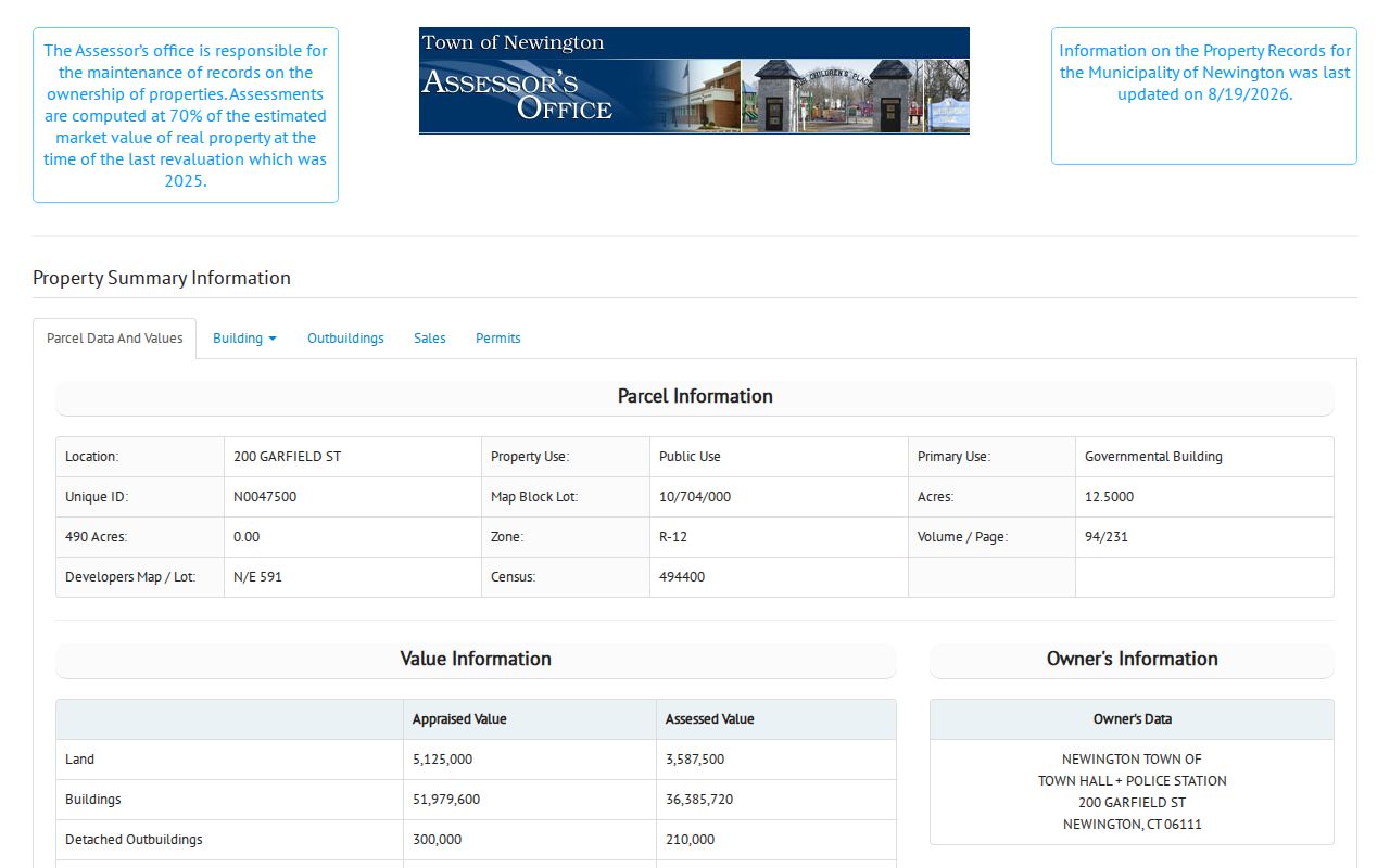
The public 200 Garfield sample is a safe civic parcel. Its card shows an owner, public-use classification, building and permit fields, map access, and sales-history references. It demonstrates the record shape without publishing a private household.
MapXpress Layers for a Newington Address
Newington GIS and MapXpress add geography that a property card cannot show. The viewer accepts Property Search Name, House No, Street, Parcel Id, and Unique ID. It can select a parcel, open a property popup, browse an adjacent shape, use multi-select or a buffer, measure, and print. The parcel map page states a July 2026 map update and nightly property-information updates. The viewer lists about 12,500 parcels and separates the parcel ID format from the assessor unique ID.
Layers include voting districts, zoning, overlays, easements, wetlands, storm sewer, sales by Grand List year from 2021 through 2025, historic aerials, FEMA flood zones, and other state or federal context. A layer describes geography. It is not a deed, survey, title search, or final boundary ruling.
The Newington GIS map shows the controls used for address and parcel work.
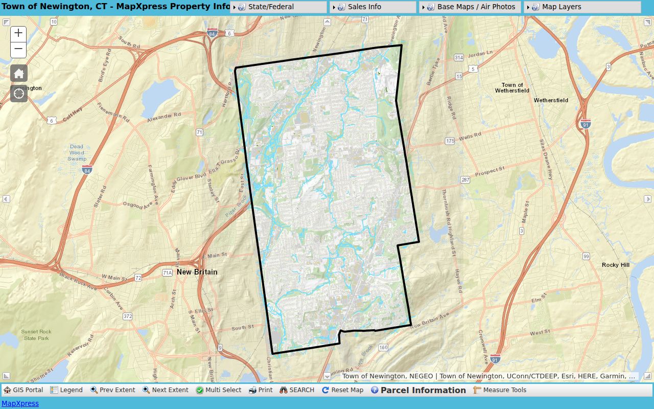
Save the selected parcel, map scale, layers, and retrieval date. Those details make an address result reproducible when the town updates its map.
Newington Street Records on Berlin Turnpike
Newington's Street Listings by District PDF shows why a street name alone can be too broad. Berlin Turnpike is split into at least three listed ranges: 2089-2335 in district 001, 2355-2909 in district 002, and 2920-3585 in district 005. A search for “Berlin Turnpike” without the number cannot decide which polling place or district belongs to the address.
The seven district buildings are Mortensen Community Center and Town Hall for district 1, Ruth Chaffee School for district 2, Anna Reynolds School for district 3, Elizabeth Green School for district 4, John Paterson School for district 5, John Wallace Middle School for district 6, and Martin Kellogg Middle School for district 7. The town's polling-place page is the current office route for checking the civic assignment. Districts also map into state legislative geography. These are civic crosswalks, not lists of households.
Note: The district PDF was printed June 27, 2022, so the number range and polling-place information should be rechecked for the current election cycle.
Newington Records Searchable by Street
The Newington street directory is assembled from record sets with different keys. Some are directly address-based. Others become searchable by street only after the assessor or map supplies a name or parcel. The table keeps the source roles apart.
| Record set | Address key | What it shows | Access |
|---|---|---|---|
| Assessor card | Number, street, unit, MBL, unique ID | Owner display, values, use, building, sales and permit clues | Public portal |
| GIS parcel | House number, street, parcel ID | Shape, popup attributes, abutters, districts and map layers | Public viewer |
| Town Clerk index | Party name, volume/page, date | Deeds, liens, maps, and other recorded instruments | Index and image rules differ |
| Tax account | Location, name, bill, unique ID, list number | Account or bill lead and account type | Public search, no bill opened |
| Voter district list | Street and number range | District and polling-place context | Official dated PDF/page |
| Historical directory | Printed street or address | Dated person or household lead | Library, archive, or microfilm |
The exact source date belongs beside every result. A tax account, deed party, permit applicant, or historic entry should not be collapsed into one undated claim about who lives on a street. The Newington tax information page explains the account-search route and payment context.
- Parcel
- A mapped unit of land with a local identifier, used to connect the assessor and GIS to a record.
- Situs address
- The address where the parcel or building is located, which can differ from a mailing address.
- Plat
- A recorded map or plan that helps describe lots, lines, streets, or subdivisions.
- Criss-cross directory
- A historical address-to-name source that can show a listed household lead for a year.
From a Newington Street to the Deed Index
Newington land records are indexed by name. Once a property card or Grand List supplies a volume/page clue, search the current owner as grantee to locate the purchase deed. Read the seller as grantor, then search that earlier party as grantee for the prior purchase. Repeat until the index cutoff or an earlier paper source interrupts the chain.
A live Town Clerk portal capture is the right reference point for the search fields, but the unattended research did not retain a Newington transaction row. The official Newington land-record instructions explain the portal, image access, and local copy route.
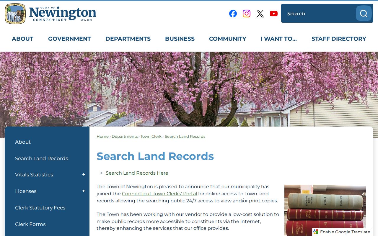
The image belongs before any name search because it shows the official access path. A result must still be checked for town, grantor, grantee, instrument type, recording date, volume/page, legal description, and image status.
The Connecticut Town Clerks' Portal is the second official reference point for Newington's land-record access and account controls.
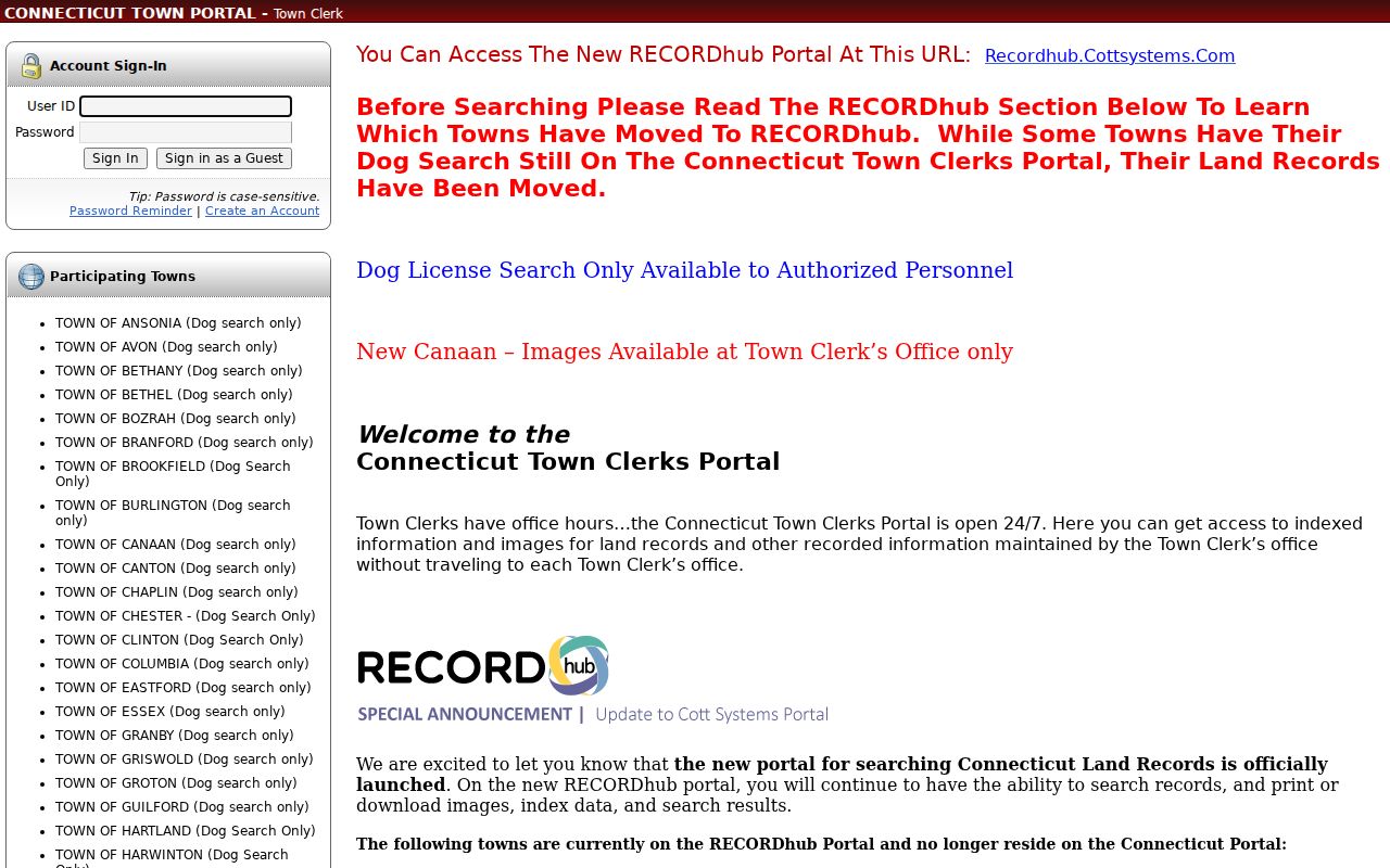
The portal capture shows why a guest or account screen is not the same as a returned Newington deed row. Preserve the live town row and image status before publishing a transaction detail.
The portal displayed Newington image availability from March 21, 1985, while the town FAQ reports a computer index from 1976. Earlier links may require the clerk's counter, deed books, microfilm, or archive. A land-record copy is listed at $1 per page, and the Town Clerk statutory-fee schedule lists the separate certification and recording charges.
Newington Street Records in Revaluation
A parcel card can expose permit number, type, date, description, and building characteristics. Those fields can explain why a house record changed or identify the department whose file should be requested. A permit records an application or project. It does not identify every person who used a building.
The 2025 townwide revaluation adds a time-sensitive street angle. Newington published residential sales reports by street and style for January 2024 through August 2025, and the new Grand List affects bills beginning in July 2026. The 70 percent assessment basis and the market or sale information should be kept separate. A townwide change does not prove a particular parcel's sale price or current worth.
Use the assessor card for the first clue, then ask the responsible town department for the official permit or assessment record. Preserve the unique ID and date so a future card refresh can be compared with the earlier capture.
USPS and ZIP Checks for a Newington Street
USPS is the address-normalization source, not a people directory. The verified current street-address example for Newington uses ZIP 06111 and the Newington Post Office at 75 Lowrey Place. Official postal material also shows a 06111 and 06131 relationship, but the reviewed sources did not verify a separate current 06131 street-address area. A live city/state query should settle the current delivery result.
For a street directory, preserve the exact USPS query, returned ZIP or ZIP+4, retrieval date, town spelling, assessor key, GIS parcel, and district result. A ZIP is not a voting, school, court, neighborhood, or title boundary. The USPS ZIP Code Lookup itself warns that a ZIP result does not verify a person or organization at an address.
Note: Use the number and street with USPS, then return to the Newington assessor and GIS tools for parcel-level work.
Historic Newington Street Maps and Indexes
The Static Map Library holds a current Street Index, Street Listings by District, historic maps, cemeteries, voting districts, schools, land use, and zoning. The 1869 and 1934 maps are useful visual checkpoints around incorporation and early transportation growth. They show routes and place context, but they do not create a modern number-by-number conversion.
Newington's earlier geography matters. The area was tied to Wethersfield from 1636, took the Newington name in 1721, and incorporated in 1871. A pre-incorporation property or family record may use Wethersfield. The legal description, volume/page, field card, historic map, and parcel should be compared before a historical street label is matched to a current address.
For the Newington Static Map Library, save the PDF title, print date, page, and layer or map name.
Newington Street Directory History
A criss-cross or reverse directory starts with an address and supplies a dated listed person. The Library of Congress distinguishes that format from a telephone, business, or ordinary alphabetical city directory. Newington's exact reverse-directory run was not verified in the local pages, so a library, State Library, LOC, or archive request should name the city, street, directory type, and exact year.
Pair the printed street entry with a census when the years align, then test the name against a deed, obituary, probate matter, newspaper, school yearbook, or Historical Society collection. A directory can include a renter or boarder. A deed can name a party who did not live at the property. The source type and date are part of the conclusion.
The historical shelf is described in more detail on the Newington directory book page, while a current one-person question belongs in a resident lookup.
What a Newington Street Directory Cannot Show
A Newington street directory cannot enumerate every household member or certify who sleeps in a building. The assessor may show a taxable owner. A deed shows recorded parties. A tax portal shows an account. Voter data has its own release and privacy rules. DMV records are restricted under CGS §14-10 and the federal Driver's Privacy Protection Act. Utility and delivery-customer lists are not public.
Safe at Home can provide a substitute mailing address for eligible participants, and the separate Voter Registry Privacy Program can protect a name or address when disclosure creates a safety risk. Do not use a parcel map or another public layer to reverse-engineer a protected physical address. An empty result can also reflect a sealed, erased, juvenile, adoption, or otherwise confidential record.
Lawful use. Newington address records support personal research, family history, and house history. Do not use them to stalk, harass, threaten, intimidate, or harm anyone. Verify disputed information with the custodian.
Requesting Newington Address Records
When a portal stops short, name the custodian and ask for an existing record. A Connecticut Freedom of Information request does not need a special form, but it should identify the office, the exact record or field set, a date range, preferred format, and any fee ceiling. Municipal copies are generally capped at 50 cents per page under the state's guidance, while land, vital, court, or other statutes can control separate fees.
For a street question, include the exact number, street spelling, parcel or MBL, unique ID, record type, and date range. Ask the Town Clerk for a deed or map, GIS for a parcel or layer export, the Assessor for a card or sales report, the Registrar for the proper voter route, and the library or archive for a directory or map. This keeps a request narrow and makes the returned role clear.
Note: A good street directory result is a dated crosswalk, not a household list.